Seabed 2030 Project
December Engagement
St. Thomas, U.S. Virgin Islands
December 8-11, 2022
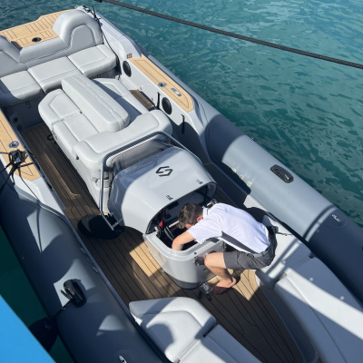
The International SeaKeepers Society is partnered with Seabed 2030 to crowdsource data collection using data loggers that attach to the navigational instruments of privately owned vessels. The International SeaKeepers Society attended the Caribbean Yacht Show in St. Thomas and successfully installed 5 loggers onto vessels attending the show. Sailing vessel Mariah Princess III, Corazon, Next Chapter, Slipstream, and Aquanova are all now DISCOVERY Yachts participating in the Seabed 2030 program!
Purpose of Research
The Nippon Foundation and GEBCO founded Seabed 2030 in 2017 to coordinate and oversee the sourcing and compilation of bathymetric data through its five data centers into the freely-available GEBCO Grid to produce a definitive map of the world ocean floor.
Duration of Project
June 2022 - Present
Application
Only 20% of the ocean floor has been mapped to date. Mapping the seafloor can help us learn what resources are available on our planet and identify changes in currents that can indicate climate change. By understanding the shape of our ocean floor, we gain knowledge of geophysical drivers of ocean behavior.
Partner Sites
Partner Logo