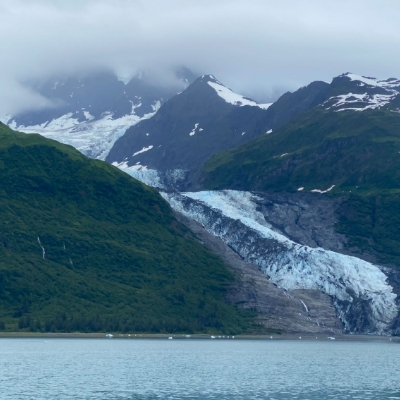
Alaskan Glacier Analysis

DISCOVERY Yacht Jillian Glenn
Prince William Sound, Alaska
July 4 - July 15, 2022
Leadership
Research Team
- Dr. Bruce Molnia Ph.D.
- Ben Molnia
- Captain Rodney Moll
Purpose of Research
Precision repeat photography was used to visually document the extent and magnitude of glacier and landscape change resulting from post-Little Ice Age climate change. Repeat photography is a technique in which a historical and a modern photograph, both having similar fields of view, are compared and contrasted to quantitatively and qualitatively determine their similarities and differences. In precision repeat photography, both photographs have the same field of view, ideally being photographed from the identical location. New repeat photography pairs will be made for each site photographed.
Project Overview
From July 4, 2022 through July 15, 2022, Glacier Geologist Bruce Molnia, Captain Rodney Moll, and Geospatial Scientist Ben Molnia conducted an Explorers Club Flag Expedition in Prince William Sound, Alaska. The expedition was conducted using DISCOVERY Yacht Jillian Glenn, a 36’ expedition landing craft, operated by Captain Moll. Prince William Sound has the largest number of temperate tidewater glaciers on Earth, as well as hundreds of valley-, mountain-, and cirque-glaciers.
During the 11 days of the expedition, more than thirty-five (35) Prince William Sound glaciers were visited and photographed from about 100 locations where one or more historical photographs had previously been taken. Many of the glaciers were photographed from multiple unique locations.
The earliest historical photographs that the expedition duplicated were taken in 1899 during the Harriman Expedition. Many others, dating from 1908 and 1909 were taken by US Geological Survey geologists US Grant III and Dennis Higgins during their assessment of Prince William Sound’s mining activities. Other photographs were taken by American Geographical Society expeditions under the leadership of William O. Field between 1926 and 1976. Many others were taken by Expedition scientist Bruce Molnia during multiple previous visits to the Sound between 1974 and 2016.
Glaciers that the expedition visited and photographed included: Aialik Glacier, Amherst Glacier, Bainbridge Glacier, Baltimore Glacier, Baker Glacier, Barry Glacier, Beloit Glacier, Blackstone Glacier, Brilliant Glacier, Bryn Mawr Glacier, Cascade Glacier, Cataract Glacier, Chenega Glacier, Columbia Glacier, Contact Glacier, Coxe Glacier, Crescent Glacier, Dirty Glacier, Falling Glacier, Harriman Glacier, Harvard Glacier, Holyoke Glacier, Lawrence Glacier, Marquette Glacier, Meares Glacier, Northland Glacier, Princeton Glacier, Surprise Glacier, Taylor Glacier, Tebenkoff Glacier, Tiger Glacier, Tiger Tail Glacier, Toboggan Glacier, Ultramarine Glacier, Vassar Glacier, Wellesley Glacier, Worthington Glacier, Yale Glacier. At each location visited, multiple photographs were taken, and the latitude and longitude, and the date and time of the visit were recorded.
All but two of the glaciers visited showed significant evidence of recent thinning and retreat. Two, Harvard Glacier and Meares Glacier, were advancing. Over the next few months, the new photographs will be processed and analyzed, new pairs will be made for each location visited, and a summary of the behavior of each glacier visited will be prepared. Sites that previously had pairs will be upgraded to photo triplets.
Application
By photographing the same location several time over many years, it is easy to see if these glaciers are receding at a rate that indicates climate change. What is seen here could also be an idicator of how the polar glaciers are behaving, or will behave in the near future. Eventualy, if Polar regions begin to recede in this way, that could mean a sea level rise that would inundate many coastal regions around the world. As we know, many major cities with huge population are located in the areas that would be most affected. Additionally, the fact that two of the more than 35 sites photographed actually advanced, as opposed to receding, shows that this is more complex with many factors that contribute to these outliers. Without understanding more about actual science behind these observations, some may point to this as "proof" that the Earth's climate is doing just fine. This would be an inaccurate conclusion, which is why this research will be very important now and into the future.
Expedition Goal
Precision repeat photography was used to visually document the extent and magnitude of glacier and landscape change resulting from post-Little Ice Age climate change.
Location
35 Glaciers throughout Prince William Sound, Alaska
