Manta Ray Surveys with Manta Watch New Zealand
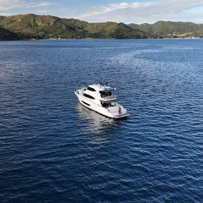
DISCOVERY Yacht Saluté
Hauraki Gulf, New Zealand
May 12-14, 2024
Leadership
Research Team
- Lydia Green
Project Overview
Manta rays, the largest ray species in the world, can reach up to 7 meters wide. Typically solitary, they gather in groups when food is abundant, particularly to feast on krill. Verified sightings data, including GPS coordinates, time, date, and observed behavior, are used to create detailed manta sightings maps, which help us understand how and when mantas use specific locations.
Duration of Project
Ongoing
Expedition Summary
The International SeaKeepers Society South Pacific facilitated a 3-day expedition aboard DISCOVERY Yacht Saluté. Manta Watch NZ have very little survey effort for late Autumn, so this was a completely new exploration.
The first day, the team survey from Great Barrier Island, through the center of the Hauraki Gulf, northwest past the Hen and Chicken Islands and into Tutukaka, south of the Poor Knights Islands. Day 2 the team circumnavigated the Poor Knights, back down to Great Barrier Island via the offshore 200m contour. It was important for the researchers to record changes in sea temperature and assess the deeper, warmer waters where manta rays, devil rays and whale sharks were more likely to be situated.
Day 3 consisted of a thorough survey of the Craddock Channel, between Little Barrier and Great Barrier, traveling southeast and then northwest through historic manta ray hotspots, including Simpsons Rock before returning to Great Barrier Island.
Unfortunately, there was very little marine life encountered during the 3 days, one theory for this was the presence of significant solar flares (auroras), which may have impacted the wildlife’s behavior and distribution. Luckily no data is still data, with the trip providing fantastic insights and baseline data for future late season surveys.
Application
One major benefit of using drone technology to collect photos ID of manta rays is safety, as it is much less risky than traditional methods. Additionally, drones enable researchers to track mantas over longer distances when they resurface and facilitate citizen science involvement. Sightings records are continually updated through real-time citizen science submissions and dedicated manta ray surveys, enhancing our understanding of manta ray behavior and distribution.
Location
Hauraki Gulf, New Zealand


You must be logged in to post a comment.