Oceanic Manta Ray surveys in the Hauraki Gulf with Manta Watch NZ
DISCOVERY Yacht Neo
Auckland, New Zealand
February 5 - 7, 2025
Project Overview
Manta rays, the largest ray species in the world, can reach up to 7 meters wide. Typically solitary, they gather in groups when food is abundant, particularly to feast on krill. As critical indicators of ocean health, oceanic manta rays play a key role in marine ecosystems by linking nutrient cycles across vast areas. However, their presence and behaviors in New Zealand waters, particularly the Hauraki Gulf, remain poorly understood. Verified sightings data, including GPS coordinates, time, date, and observed behavior, help create detailed manta sightings maps, providing insight into how and when mantas use specific locations. Focused research on these rays is vital for uncovering their seasonal movements and ecological roles, ultimately informing strategies to ensure their conservation.
Application
A key advantage of using drone technology for photographing manta ray IDs is safety, as it significantly reduces the risks associated with traditional methods. Drones also allow researchers to monitor mantas over greater distances when they resurface and encourage citizen science participation. Sightings data are continuously updated through real-time citizen science contributions and dedicated manta ray surveys, helping to expand our knowledge of manta ray behavior and distribution.
Expedition Summary
From the 5th to the 7th of February, The International SeaKeepers Society South Pacific facilitated a two-day expedition in the Hauraki Gulf aboard DISCOVERY Yacht NEO. The team surveyed key regions, starting from Great Barrier Island and heading toward the Hen and Chicken Islands, around the Poor Knights and over to Tutukaka, and the northeast and southeast coasts of Little Barrier Island, before concluding along the west coast of Aotea/Great Barrier Island.
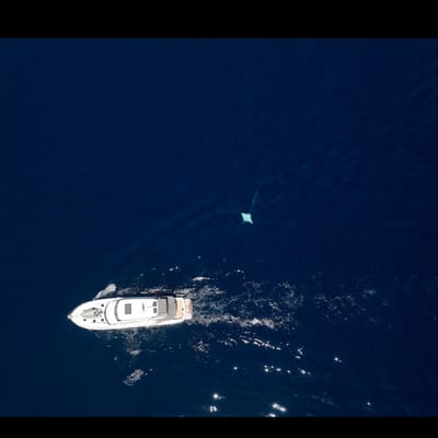
Throughout the expedition we spotted two manta rays, we were able to get the drone up to get a ventral ID of one manta. This manta was also very curious and spent a lot of time circling the boat allowing us to get a good look up close.
Within those two days the first day we spent 11 hours and 7 minutes surveying and covered a distance of 135.1 km. While surveying we took part in an active survey using the ORCA app to report any marine mammals or cetaceans along the way. On day 1 we reported over 40 common dolphins, 3 Bryde's whales and 1 unidentified whale and cetacean. Day 2 we surveyed for 8 hours 21 minutes and covered 128.8 km spotting 8 bottlenose dolphins and 1 unidentified cetacean. While the weather conditions were ideal we did not encounter as much krill and therefore not as many mantas are spotted for this time of year.
Location
Hauraki Gulf, New Zealand
Duration of Project
January 5th-7th, 2025
Leadership
Research Team
- Lydia Green
You must be logged in to post a comment.