Permit Spawning Aggregation Dynamics (leg 3/4)
SeaKeepers Vessel DISCOVERY
The Keys, Florida
May 2-10, 2023
Research Team
Project Overview
The purpose of this research is to monitor permit spawning aggregations on natural and artificial reefs in the Florida Keys, collecting data on aggregation size and distribution, fishing pressure, and depredation mortality.
Duration of Project
2018 - Present
Expedition Summary
From May 2nd-10th, 2023, The International SeaKeepers Society assisted researchers from Florida International University and Carleton University, supported by Bonefish & Tarpon Trust, in conducting research on permit (Trachinotus falcatus) spawning aggregations in the Lower and Middle Florida Keys. Permit aggregate on natural and artificial reefs in the Keys surrounding the full moons from March through June each year. Catch-and-release angling for permit during their spawning season has become a popular sport fishery for many anglers, and, although not inherently detrimental to the fishery since permit harvest is prohibited between April 1 and July 31 throughout the Florida Keys, depredation (i.e., the removal of hooked fish by a predator) has produced a high level of concern regarding the sustainability of this practice.
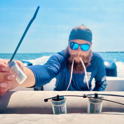
As a result, Florida Fish and Wildlife Conservation Commission implemented a seasonal fishing closure from April 1 – July 31 each year at Western Dry Rocks (WDR), where depredation mortality has been historically high, to protect permit and other species that aggregate here. To evaluate the efficacy of this closure and monitor other fished aggregation sites throughout the Florida Keys, we used a combination active acoustics (multi-beam imaging sonar), video (360° and line-cameras), environmental DNA collection, permit cloacal swabs, and hook-and-line fishing surveys to gather data on permit school distribution and abundance and individual fish size. Observational data on fishing pressure (i.e., number of fishing boats, time spent fishing) and depredation rates (i.e., number of angled permit lost to sharks) at openly fished sites were also collected. We deployed environmental sensors near permit aggregations to collect temperature and light data within the water column. Additionally, we traveled to the Dry Tortugas to scout for historical permit aggregations and explore this location as a potential field site.
Some highlights from data collected on this trip:
- Fishing pressure in the Middle Keys consisted of 1-4 boats spending 0.2-2.2 hrs fishing for permit. At sites in the Lower Keys, we did not observe any boats targeting permit, including WDR where the closure went into effect on April 1st.
- We observed sharks across several sites, including Caribbean reef (Carcharhinus perezi), great hammerhead (Sphyrna mokarran) and spinner sharks (C. brevipinna), but we did not observe any depredation events.
- Our initial results from the combined acoustic and video data suggest that abundance ranged from 1-500 individuals at all sites where permit aggregations were observed. School size at WDR (Lower Keys) was larger than the Middle Keys sites.
- We once again worked with Jessica Robichaud (Carleton University), Dr. Jake Brownscombe (Carleton University, Fisheries and Oceans Canada), and Dr. Luke Griffin (University of Massachusetts Amherst) to capture and surgically implant >10 acoustic transmitters in permit at Middle Keys sites, building upon multiyear tagging efforts.
- The range of permit sizes (55-73 cm fork length) was similar between Middle Keys (average 65.5 cm) and Lower Keys fish (average 65.8 cm).
- We collected 16 cloacal swabs from permit, which will be used to analyze their fecal DNA and determine their diet during the spawning season.
- We collected environmental DNA water samples to validate this method as a tool to assess permit presence and abundance.
- Environmental sensors demonstrated variation in temperature and light stratification across sites in the Middle and Lower Keys, which can be correlated to permit distribution.
- Although we did not observe permit schools at the Dry Tortugas, the capability of the SeaKeepers vessel Discovery shows promise for future research trips at this remote location.
Application
The data collected on this trip will be used to assess seasonal and annual variation in permit spawning aggregation density and distribution across several sites in the Lower and Middle Florida Keys, as well as, after this expedition, areas of Dry Tortugas National Park. Moreover, the observational data from this trip will be used to quantify recreational fishing effort and associated depredation rates at openly fished sites, which is critical in understanding the extent of depredation mortality and its effect on permit spawning aggregation dynamics.The acoustic tagging efforts will also build upon previous telemetry data to assess residency and movements across habitats and aggregation sites in the Florida Keys. Environmental sensor data will be used to inform on the drivers of permit distribution across sites. DNA analyses of water and permit fecal samples will shed light on the viability of new methods to determine permit abundance and diet during their spawning season.


You must be logged in to post a comment.