Background:
Since 2014, NOAA, the Integrated Ocean Observing System (IOOS), and partnering universities have deployed robotic gliders in a “picket-line” formation stretching from the Caribbean, the Gulf of Mexico, the South Atlantic Bight, and northwards into the Mid-Atlantic Bight (MAB). The purpose of these directed deployments is to improve ocean and atmospheric forecast models by directly measuring both the upper ocean heat content, and the stratification of the water column. Recent papers have reviewed how these in-situ measurements have significantly improved the intensity forecasts of storms and demonstrated that characterizing the vertical thermal structure of shallow continental seas in the Mid-Atlantic was critical for predicting the intensity of tropical cyclones. The importance of obtaining these observations was highlighted when the National Hurricane Center over-predicted the intensity of hurricane Irene in 2011 because the ocean models did not accurately reflect the location or amount of cold water underneath the warm ocean surface in the western Atlantic. This underscores the importance of accurate, timely, in-situ ocean observations of water column structure as a critical factor in ocean and atmospheric forecasting in the western Atlantic. While robotic platforms, such as gliders, can have directed deployments, they move slowly (~20 km per day) compared to tropical cyclones (~300 km per day). Therefore, relative to the timescale of an active storm forecast cycle, they essentially operate like quasi-stationary profiling platforms with a very limited geographic footprint. Furthermore, a recent study highlighted the significant gaps in coverage of long-term ocean observing systems and programs (e.g. the Argo program), including marginal seas and continental shelf habitats like the MAB, highlighting the need for improved ocean observation capacity in these regions.
One solution to this problem is to implement a relatively low-cost, long endurance, distributed network of animal-borne ocean observing tags as a complement to more directed robotic deployments and other oceanographic platforms. Advances in electronic tagging technology have facilitated the ability to use tagged animals as autonomous ocean sensors, collecting a range of environmental data during their movements, including temperature, conductivity, light level, oxygen, and chlorophyll. Using tagged animals as autonomous ocean profilers provides real-time in-situ information on oceanographic conditions, including ocean heat content and stratification data associated with high quality locations. Because marine animals are often fast moving, wide ranging, and deep diving, they provide broad spatial, vertical, and temporal oceanographic coverage, at a minimal cost compared to oceanographic cruises and glider deployments. Another benefit is that electronic tags can provide extended periods of ocean observation, ranging from months to years.
Biologging tags are a powerful, yet underutilized tool for ocean observing. While the use of tagged animals as ocean sensors has been quite successful in polar regions, this approach has been rarely used in mid to low-latitudes regions where there remain important gaps in oceanographic observations. A recent (2019) study highlighted how ocean observing programs can be significantly improved through the integration of animal-borne ocean observing tags. This study found that animal-borne sensors could provide valuable observations in a variety of regions that are currently being under sampled, including the upper water column (upper 10 m), continental shelf, marginal seas (including EEZs), and upwelling areas. We are working with the Sea Mammal Research Unit (SMRU Instrumentation, University of St. Andrews, UK) to test and deploy their next generation CTD tags on sharks. Earlier models of these tags, which were significantly larger, have been successfully deployed on marine mammals (primarily seals) since 2004 and their data assimilated and used for both operational and oceanographic modeling purposes.
Mission:
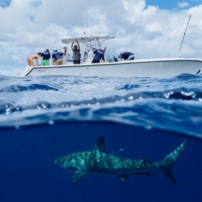
The Primary objective of this proposal is to deploy the new CTD tags and PAT tags onto pelagic sharks and collect biological samples from sharks and their potential prey off the coast of Delaware. The team is targeting pelagic sharks, such as Shortfin Mako and Blue Sharks, and require a vessel that is able to access offshore waters near the continental shelf break. This could be done by transiting daily from shore to fishing locations offshore, but the ability to remain on station in offshore waters is ideal.
CTD tags will be attached to the dorsal fins of the sharks while a PAT tag will be attached to a subset of animals. All sharks will have basic metadata collected (species, size, sex, etc.) and tissue samples collected for chemical analyses. Given the difficulty in accessing these offshore habitats, the team will leverage this opportunity to obtain tissue samples from other species, including potential shark prey. They will also collect samples of zooplankton and phytoplankton using plankton nets while offshore and environmental data (water temperature, salinity, dissolved oxygen) while onboard. These samples collected from sharks and other species will be used to study the trophic ecology of pelagic sharks and pelagic food web dynamics through the use of chemical tracer techniques (stable isotope analysis).
Application:
The data will be used to inform different ocean models and storm predictions. These will be used to help guide planning efforts associated with extreme climate events and hurricanes in particular.


