Seabed 2030 Project
Support Vessels for X4CF
Lake Worth, Florida
June 25, 2022
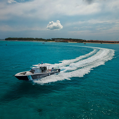
The International SeaKeepers Society is partnered with Seabed 2030 to crowdsource data collection using data loggers that attach to the navigational instruments of privately owned vessels. Seven support vessels located at the 2022 Crossing for Cystic Fibrosis took on loggers to map their voyage from Bimini, The Bahamas across the Atlantic back to Lake Worth, Florida to record their route and depth information for areas of the ocean floor that may not have been mapped before. These vessels include SeaKeepers Vessel DISCOVERY, Diversion, Consort, Magic Moment, Peeling 20's, and two unnamed vessels.
Purpose of Research
The Nippon Foundation and GEBCO founded Seabed 2030 in 2017 to coordinate and oversee the sourcing and compilation of bathymetric data through its five data centers into the freely-available GEBCO Grid to produce a definitive map of the world ocean floor.
Duration of Project
June 2022 - Present
Application
Only 20% of the ocean floor has been mapped to date. Mapping the seafloor can help us learn what resources are available on our planet and identify changes in currents that can indicate climate change. By understanding the shape of our ocean floor, we gain knowledge of geophysical drivers of ocean behavior.
Partner Sites
Partner Logo
You must be logged in to post a comment.