Seabed 2030 Project
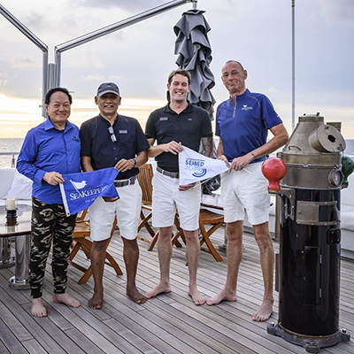
DISCOVERY Yacht Aqua Blu
Indonesia & Singapore, Southeast Asia
June 2022
The International SeaKeepers Society is partnered with Seabed 2030 to crowdsource data collection using data loggers attached to privately owned vessels that can traverse areas of the ocean that have not been mapped in this way. These simple data recording devices connect directly to a vessel's navigational instruments to record route and depth on any given voyage. DISCOVERY Yacht (D/Y) Aqua Blu is a 198’ long-range explorer yacht that cruises the Coral Triangle of East Indonesia. We look forward to seeing what bathymetric data they can add to the General Bathymetric Chart of the Ocean.
Purpose of Research
The Nippon Foundation and GEBCO founded Seabed 2030 in 2017 to coordinate and oversee the sourcing and compilation of bathymetric data through its five data centers into the freely-available GEBCO Grid to produce a definitive map of the world ocean floor.The Nippon Foundation and GEBCO founded Seabed 2030 in 2017 to coordinate and oversee the sourcing and compilation of bathymetric data through its five data centres into the freely-available GEBCO Grid to produce a definitive map of the world ocean floor.
Duration of Project
June 2022 - Present
Application
Only 20% of the ocean floor has been mapped to date. Mapping the seafloor can help us learn what resources are available on our planet and identify changes in currents that can indicate climate change. By understanding the shape of our ocean floor, we gain knoweldge into geophysical drivers of ocean behavior.
Partner Sites
Partner Logo